Excavation Software | Earthworks for Accurate Quantity Takeoffs
By Sai Vamshi in Blog Posted June 8, 2026 Tags earthworks software,Excavation Software
What Is Excavation Software and How Does It Improve Takeoffs?
At Earthworks, we focus on solving one of the most time-sensitive problems in construction estimating—turning drawings into accurate earthwork quantities without unnecessary delays or manual errors.
That’s why excavation software sits at the core of how Earthworks helps contractors, estimators, and civil teams move from project drawings to reliable cut-and-fill calculations in a faster, more controlled way.
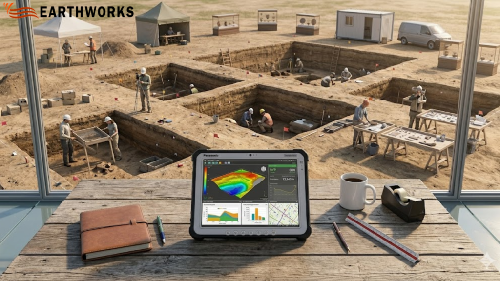
Instead of spending hours tracing plans or building spreadsheets from scratch, Earthworks is designed to streamline the estimating process using structured digital takeoffs directly from PDF and CAD files.
The result is simple: clearer quantities, faster turnaround, and more consistent estimates.
Built for real estimating challenges in construction
Earthworks is designed specifically for excavation takeoffs and earthwork estimation workflows. It focuses on accuracy at the earliest stage of project planning—where most cost and time risks begin.
With Earthworks, users can:
- Import PDF and CAD drawings for direct measurement
- Perform digital excavation takeoffs on plan surfaces
- Generate cut, fill, and net volume calculations
- Reduce manual tracing and spreadsheet dependency
- Work with structured, repeatable estimating workflows
Everything is built around improving speed and consistency in earthwork estimation.
How excavation software improves estimating accuracy
Traditional excavation estimating depends heavily on manual interpretation, which often leads to variation between estimators and repeated corrections later in the process.
Using digital tools, design drawings are converted into measurable surfaces.
This allows users to:
- Measure volumes directly from design files
- Compare existing and proposed surfaces with precision
- Automatically calculate cut, fill, and net quantities
- Reduce interpretation errors from scaled drawings
- Update quantities quickly when plans are revised
By linking every calculation directly to the drawing, Earthworks reduces uncertainty in early-stage estimating.
Why accuracy matters in excavation takeoffs
In construction estimation, even small errors can scale into significant cost differences across an entire project.
Common issues Earthworks helps reduce include:
- Inconsistent manual measurements
- Errors from scaling or drawing interpretation
- Repetitive recalculation during revisions
- Variations between estimators
- Time lost in rework and correction cycles
Earthworks is designed to bring consistency to a process that is traditionally fragmented across tools and spreadsheets.
A structured workflow designed for clarity
Earthworks is built to keep the estimating process simple, structured, and repeatable.
A typical workflow includes:
- Uploading project drawings (PDF or CAD)
- Defining site surfaces for measurement
- Running excavation and fill calculations
- Reviewing cut, fill, and net results
- Updating takeoffs when drawings change
This structured approach helps reduce unnecessary complexity and keeps estimation focused on output accuracy.
Reducing estimation risk with better data control
One of the key advantages of Earthworks is improved control over estimating data.
With digital tools, teams can:
- Maintain consistency across multiple estimates
- Reduce manual calculation errors
- Ensure updates reflect across all quantities
- Standardize reporting outputs
- Support more consistent and reliable bid preparation
This level of control helps reduce risk during early project planning, where accuracy has the highest financial impact.
Why contractors and estimators use Earthworks
Earthworks is designed for professionals who need reliable earthwork quantities without spending excessive time on manual processes.
Teams choose Earthworks for:
- Faster digital takeoffs compared to manual methods
- Reduced reliance on spreadsheets and manual tracing
- Clear, structured earthwork estimation workflow
- Easy handling of drawing revisions
- Focused functionality for excavation estimating only
It is built to support estimating teams that prioritize speed, accuracy, and repeatability.
Trust and reliability in estimating workflows
Earthworks is developed around a principle of measurable accuracy—helping ensure outputs are based directly on source drawings rather than manual interpretation.
This improves:
- Experience: Built around real-world estimating workflows
- Expertise: Focused on excavation and earthwork takeoffs
- Authority: Designed specifically for construction estimating use cases
- Trust: Transparent, drawing-based measurement system
Keeping calculations grounded in design data helps improve clarity in early-stage project estimates.
Where excavation software is heading in construction
The estimating process in construction is rapidly becoming more digital and data-driven.
With digital excavation tools, the industry is moving toward:
- Faster, more repeatable digital takeoffs
- Reduced reliance on manual measurement workflows
- More consistent quantity forecasting
- Standardized estimating outputs across teams
- Improved handling of drawing revisions
Earthworks fits into this shift by focusing strictly on excavation and earthwork estimation workflows.
Final thoughts
Earthworks in San Diego is built to help construction teams produce faster, more accurate excavation takeoffs.
Replacing manual measurement with structured digital workflows improves consistency in quantity calculations and reduces time spent on repetitive estimating tasks.
From design drawings to earthwork quantities, the process becomes clearer, faster, and more reliable—giving teams greater confidence in every estimate.
For modern construction estimating, that clarity is not just helpful—it’s essential.
READ MORE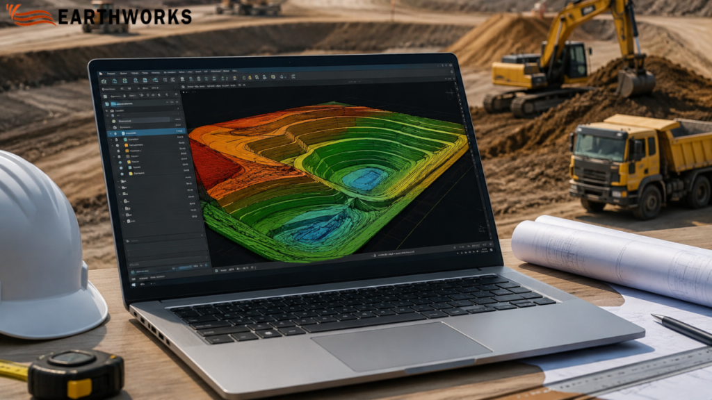
Recent Comments